Mutare
 |
 |
Located near the border with Mozambique, Mutare has long been a centre of trade and a key terminus en route to the port of Beira (in Beira, Mozambique). Mutare is hub for trade with railway links, pipeline transport and highways linking the coast with Harare and the interior. Other traditional industries include timber, papermaking, commerce, food processing, telecommunications, and transportation. In addition the city serves as a gateway to the scenic Eastern Highlands, nearby Gorongosa National Park and the Mozambique coast.
Although the city was founded in the late nineteenth century, the region has a long history of trading caravans passing through on the way to the Indian Ocean, from ports such as Sofala, to inland settlements, such as Great Zimbabwe. Zimbabwe is also renowned for its soapstone carvings and figurines which are evidence of these trade routes, dating as far back as the late African Iron Age (c. 900 AD) right up to the colonial period. A large hoard of soapstone carvings, jewellery, weapons, sherds and other objects were found in the vicinity of Mutare by the British archaeologist E M Andrews at the beginning of the twentieth century - they were later donated by the trustees of Cecil Rhodes to the British Museum in 1905. The soapstone figures, which are both anthropomorphic and zoomorphic, might have been part of a votive offering, as they were discovered near what appeared to be an altar. Mutare was founded in 1897 as a fort, about 8 km from the border with Mozambique, and is just 290 km from the Mozambican port of Beira, earning Mutare the title of "Zimbabwe's Gateway to the Sea". It is sometimes also called "Gateway to the Eastern Highlands". Many Zimbabwean locals refer to it as 'Kumakomoyo' (place of many mountains). There is a border railway station on the railway line from Bulawayo to Beira with a railways mechanical workshop.
The area was the site of Chief Mutasa's kraal. In 1890 A. R. Coquhoun was given concessionary rights and Fort Umtali (the fort later became Mutare) was established between the Tsambe and Mutare Rivers. The word mutare originates from the word 'Utare' meaning iron (or possibly meaning gold). The name was probably given to the river as a result of gold being discovered in the Penhalonga valley through which the Mutare River runs.
In 1891 the location was moved to a site now known as Old Mutare, about 14 km north of the city centre. In 1896 the construction of the railway between Beira and Bulawayo led to the town being moved a third time so that it was closer to the railway line – compensation was paid by the British South Africa Company to the townspeople for the cost of moving. The town was proclaimed a municipality on 11 June 1914 and in 1971 it was granted city status. The name was officially changed from Umtali to Mutare in 1982.
The white population in Umtali dropped from 9,950 in 1969 to 8,600 in June 1978.
The city had a tramway from January 26, 1897 to May 23, 1921 which transported passengers from the Railway station up to the (then Umtali Club) now Mutare Club. The Tramway was at the centre of Main Street where the palm trees now stand.
There were plans to set up a Stock Exchange in Umtali. The main post office was at the site where CABS centre now stands.
Map - Mutare
Map


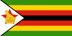
Country - Zimbabwe
 |
 |
| Flag of Zimbabwe | |
The British South Africa Company of Cecil Rhodes demarcated the Rhodesia region in 1890 when they conquered Mashonaland and later in 1893 Matabeleland after a fierce resistance by Matabele people known as the First Matabele War. Company rule ended in 1923 with the establishment of Southern Rhodesia as a self-governing British colony. In 1965, the white minority government unilaterally declared independence as Rhodesia. The state endured international isolation and a 15-year guerrilla war with black nationalist forces; this culminated in a peace agreement that established universal enfranchisement and de jure sovereignty as Zimbabwe in April 1980. Zimbabwe then joined the Commonwealth of Nations, from which it was suspended in 2002 for breaches of international law by its government under Robert Mugabe and from which it withdrew in December 2003.
Currency / Language
| ISO | Currency | Symbol | Significant figures |
|---|---|---|---|
| ZWL | Zimbabwean dollar | 2 |
| ISO | Language |
|---|---|
| SN | Shona language |